



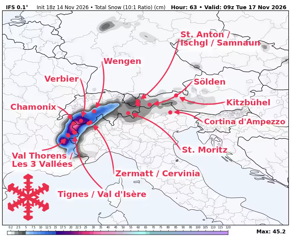

Europe’s snow forecast favors the western Alps as the ongoing storm strengthens Sunday night into Monday. Chamonix and the higher French areas lead the additional accumulations through early Tuesday, with cooling improving snow quality during the main push. These additions primarily build bases at French resorts awaiting their openings. A potentially larger reload follows later in the week, although its amounts and snow levels remain less certain.
Sunday’s lighter snowfall and pauses give way to a more organized overnight push that continues through Monday. Guidance broadly agrees on this timing, while differences in precipitation intensity leave meaningful uncertainty in totals. Snow levels generally fall from around 1,800 to 2,100 meters Sunday toward 1,500 to 1,700 meters during the colder overnight and Monday hours. French mountain temperatures mostly settle between -5°C and 0°C during the main snowfall, producing less dense snow than Sunday’s wetter additions near the snow line. Occasional stronger gusts could redistribute snow on exposed terrain. Accumulations diminish considerably toward Austria and the Dolomites.
The first round tapers Monday night into early Tuesday before a milder pause across much of the French Alps. Compared with Friday’s outlook, forecasts for matching dates have increased at Tignes and Chamonix and eased slightly at Verbier. Access still matters: Tignes targets Saturday, November 21, Val Thorens has the same scheduled opening date, and Chamonix’s first ski areas target Saturday, November 28, subject to conditions. Verbier’s limited weekend operations place Monday’s main snowfall outside its public skiing schedule. Totals below cover additional snow from Sunday morning through early Tuesday.
Another wetter period has broad support from around Tuesday into the latter part of the week, with the western Alps favored again. Repeated rounds could bring substantially more mountain snow than the first push, particularly across the higher French terrain. However, substantial spread in precipitation amounts, cooling and the pauses between waves keeps firm later resort totals premature. Milder phases could produce dense snow or rain lower down before cooling improves conditions higher up, while stronger winds may affect exposed terrain. Snow showers could linger into next weekend, but the timing becomes less settled. Austria has a smaller and more variable snowfall signal, while the Dolomites remain comparatively dry.
Europe Snow Forecast Resort Totals (Sun Nov 15 – Tue Nov 17)
Source: snowbrains.com