




Summary
Mid- and upper-elevation areas of the western Alps saw decent snow this week, while the eastern Alps got a taste on Friday. The bigger story is the upcoming storm cycle expected to commence on Sunday. We will get a teaser storm from Saturday to Monday before a prolonged period of heavy snow is expected in the western Alps, driven by a screaming Atlantic jet and a strong atmospheric river.
Short Term Forecast
It was good to see some fresh snow at elevation in both the western and eastern Alps this week, but that’s just an appetizer for the main course this week. A fast-moving storm before the main event will bring moderate to heavy snow from Saturday to Monday, mainly in the western Alps, with mainly westerly flow. Snow levels will start around 1800 m and fall to around 1500 m on Monday. Below is the latest snow forecast from OpenSnow.
This storm is just a tease compared to what the models are predicting for the rest of the week. An exciting and impressive atmospheric setup will develop in the middle of the week. This pattern will lead to a long-duration storm with massive snow totals. Two key features of this pattern are the powerful jet stream in the Atlantic and a strong atmospheric river. That is a roaring jet stream stretching over most of the Atlantic into western Europe.

This jet stream will help direct a juicy atmospheric river into the western Alps for much of next week.

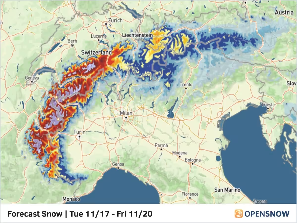
This combo will bring an extended period of moderate to heavy snow in the western Alps, with a predominantly westerly flow. This will favor the western Alps, specifically the northern French and western Swiss Alps. Snow totals in these areas should be in the .5 to 1 m + range above 2100 m. Totals will drop off farther north and east, but the central and eastern Swiss Alps as well as the western Austrian Alps in the Arlberg region should do pretty well as winds shift a bit more to the northwest.
The OpenSnow proprietary blend has some pretty big totals through Friday of next week.

Snow levels will be reasonable for this event, starting around 2400 m but quickly falling to the 1500 m to 1800 m range. That raging jet stream will bring really strong winds as well, so measuring snow up high will be quite difficult. With this main event starting on Tuesday, I will have another update and some more specifics on Monday.
Extended Forecast
We should see a break over the weekend as high pressure returns to Central Europe. Beyond that, the models do not agree on the next pattern, so we’ll have to wait a few more days at least before we know if more storms are in the forecast. Next post on Monday.
Thanks for reading the Europe Daily Snow.
Luke Stone
Forecaster, OpenSnow
Announcements
2026-2027 Winter Release
We are excited to announce the following features and innovations, created in-house by our small team at OpenSnow.
These new features are currently available on the OpenSnow iOS app and website (OpenSnow.com). They are in development for the Android app and will be available soon.
Details: 2026-2027 Winter Release
Alps Regions:


Source: opensnow.com